





Drone swarms in urban operations: NIKE-ROBComm networks drones and ground robots
The research project NIKE-ROBComm aimed to develop robust, autonomous communication and navigation for drone and robot swarms in urban environments. Project manager Christian Raffelsberger talks about goals, challenges and possible military applications.
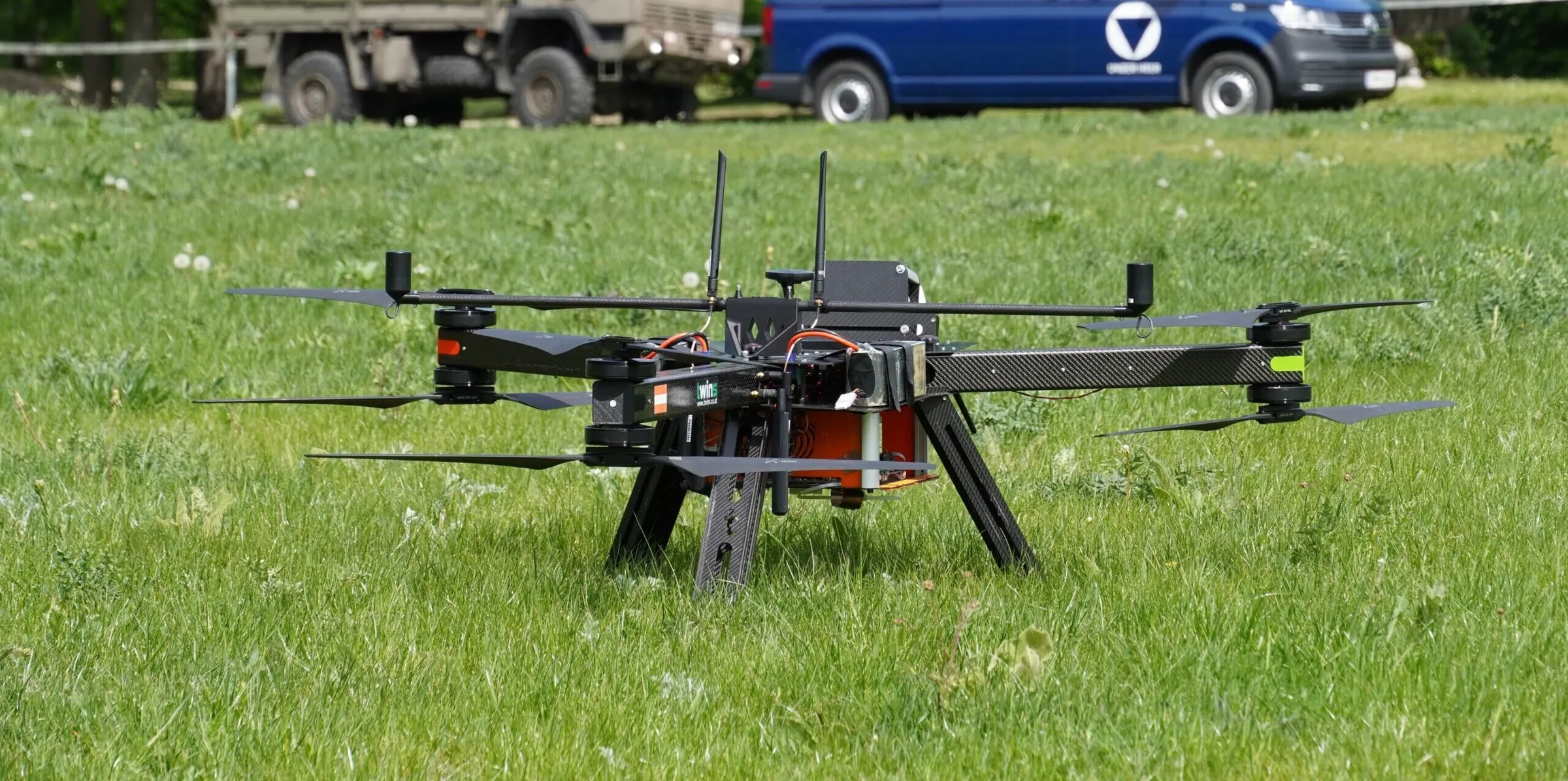
Translated from the German original interview:Reviewed by the Unmanned Magazine editorial team.
Developing robust and autonomous communication and navigation for drone swarms and robot swarms in urban environments – that was the goal of the research project NIKE-ROBComm. More than two years of research have now produced first results that help to explore danger zones and obtain an operational picture more quickly. We asked project manager Christian Raffelsberger about the goals and challenges of the project and to what extent military applications are also conceivable.
Mr Raffelsberger, please describe for us what the NIKE-ROBComm project is essentially about.
In the project, we developed the technological foundations for mixed swarms of drones and ground robots to be used reliably even in complex urban disaster scenarios. Such systems are intended to support first responders in exploring hard-to-access or dangerous areas, collect sensor data and help to create a comprehensive operational picture as quickly as possible. The overarching goal is to increase the safety and efficiency of information gathering in disaster situations.
What approach did you choose for this complex task?
To achieve the goal, several interconnected components were developed. First, robust machine-to-machine (M2M) communication for transmitting sensor data between drones and ground robots. The technological basis is ultra-wideband (UWB), which is combined with communication technologies such as 5G or WiFi. Besides communication, navigation is also decisive, even when no global navigation satellite system (GNSS) signal is available. For this purpose, research was carried out on methods for robust state estimation that enable autonomous navigation even in complex, partly GNSS-denied environments. To ensure that first responders receive the most important information, work was also done on methods for fusing and reducing sensor data.
Which concrete scenarios did you work with in the project?
One concrete use case, for example, was detecting people and vehicles, determining their exact position and transmitting this information to an operational picture system. This captured not only what is in the area of operations, but also exactly where it is.
What advantages do you see in ultra-wideband technology (UWB) in this field of application – and what are its limits?
UWB uses very short pulses for communication, which means that a large frequency band is used for transmission. In contrast to narrowband technologies, UWB is therefore less susceptible to deliberate interference such as frequency jamming, or to interference with other technologies.

UWB can also be used for localisation, which is useful precisely in areas without GNSS signals. Its limits lie above all in range, which can be restricted by obstacles such as buildings, concrete or metal. The data rate is also lower compared with technologies such as 5G or WiFi, so it is only of limited use for large volumes of data such as high-resolution videos or images. However, since the use of UWB in such robotic systems is still a comparatively young field of research, there is further potential for technical improvements and better adaptation to real operating conditions.
What solution is being created with NIKE-ROBComm, and what distinguishes the project from other existing approaches?
The result was a proof-of-concept prototype. The special approach of NIKE-ROBComm lies in the holistic consideration of the various technical, but also organisational challenges. This includes analysing acceptance among first responders, or the question of how such a system can be incorporated into future training concepts.
Project NIKE-ROBComm: flight tests took place in cooperation with the Theresian Military Acad...


What benefits do you see in civil applications – and perhaps also in the military field?
The project focuses on supporting civil emergency organisations, for example in disasters, major incidents or in hard-to-access urban areas. The technologies developed can help first responders to explore danger zones and obtain an operational picture more quickly. In principle, individual technical components, such as robust communication and localisation, can also be used for military applications.
So the military also plays a role in the project …
Yes. The Theresian Military Academy (Theresianische Militärakademie, MilAk) in Wiener Neustadt was an important partner as an end user. It contributed realistic requirements, operational knowledge and practical scenarios. In addition, workshops, several flight tests for data collection and the final integration tests took place there.
Which other cooperation partners were there?
First of all: the NIKE-ROBComm project was funded through the Austrian security research programme KIRAS with funds from the Federal Ministry of Finance via the Austrian Research Promotion Agency FFG. It was led by Lakeside Labs GmbH.
The research partners included Joanneum Research Digital, which developed the data fusion and task management, and the University of Klagenfurt, which researched novel state estimators for localisation. Industry partners were LoconIQ, a specialist in ultra-wideband technology, and twins GmbH, which develops unmanned aircraft systems. The Disaster Competence Network Austria was responsible for the social science aspects of the project.
The project ran until the end of June 2026. Looking back: what was the greatest challenge?
The greatest challenge was the high technical complexity. Within the comparatively short project duration, the individual components had to be developed and partly integrated to such an extent that they could be tested under realistic conditions. At the same time, fundamental research was still necessary in several areas, for example on novel state estimators and on integrating UWB technology on drones. In addition, to train the AI models for detecting and determining the position of people and vehicles, suitable data had to be specially collected and laboriously labelled, as existing datasets were only of limited suitability.
With all these difficult tasks: what drove you in this project?
I am particularly motivated by the fact that the research can be of concrete benefit to first responders and at the same time closely links theory and practice. Working in an interdisciplinary team is also particularly exciting, because different technical and application-related perspectives come together. Especially in joint workshops or tests in realistic environments, challenges emerge that are often not visible in simulations or theoretical considerations.
Photo credits
© Disaster Competence Network Austria · © Lakeside Labs GmbH
Continue exploring
Loitering munition Virtus from Stark: 45th Armoured Brigade “Litauen” tests it at “Freedom Shield 2026”

Drone stations for maritime surveillance: Rift begins tests off the French coast

Sea drones for the Baltic: Sweden buys surveillance from Saildrone as a service

Maritime drones: Eviden unveils SMX, an electromagnetic navigation sensor
